CreateNew Trip

[*DEMO] Plan Road Trip


  • • The experience planning App COMING SOON
  • • Create trip | Save it | Use on the road
Create1000 Towns

Explore Canadian Towns


  • • Top attractions in 1000 small towns
  • • Discover Canadian off-the-beaten path

+

Add Place

Add Town/Place


  • • Add your town or favourite place.
  • • What makes your town special?
We are currently updating trip planner for better user experience. During this period you may face loding issues. We sincerely regret the inconvenience caused by the issue.

TRAVEL LIKE A LOCAL | Top 10,000 Places to Visit in Canada

1000 towns of Canada logo
Search
Close this search box.
Search
Close this search box.

Top 8 Places to Visit in

Kangiqsualujjuaq | Quebec

The page created by Amerley | Northern Alberta Institute of Technology | Photo by Nicolas M. Perrault,CC0

Kangiqsualujjuaq | Quebec Classified

Find local news, events, services, etc., that would interest you or someone you know.

Kuururjuaq National Park

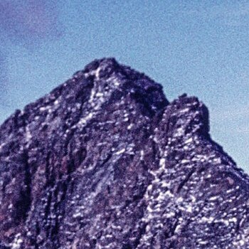
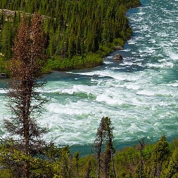
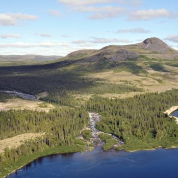
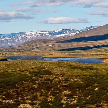
Kuururjuaq National Park stretches across 4460 square kilometres, from Ungava Bay in Quebec to Mount D’Iberville on the Newfoundland and Labrador/Quebec Border. Kuururjuaq National Park is managed by the Inuit and includes the Torngat Mountain Foothills, George River Plateau and the Ungava Coast natural regions. This vast National Park contains diverse ecosystems, including a wide variety of animals and vegetation.

Photo: DavidKalant — Travail personnel, CC BY-SA 4.0

Sending
User Review
0 (0 votes)

Mount d’Iberville

Mount D’Iberville peak was named after Pierre Le Moyne D’Iberville, a well-known French explorer of North America in the 1600s. Mount d’Iberville is the highest subpeak of Mount Caubvick, located in the Torngat Region. Its summit is the highest of all of Eastern Canada and stretches to an altitude of 1646m (5440ft).

Mount d’Iberville is not for the faint of heart. Extensive research, proper equipment and climbing experience are encouraged to take on its rocky route, knife-sharp edges and jagged ridges. In optimal conditions, a strong climber can complete the 4000 ft vertical climb in one day from basecamp. While Early August is typically the best time to tackle this peak, the Torngat region is prone to unpredictable snowstorms. In fact, two climbers perished on the descent in 2003 due to an unexpected severe snowstorm!

Photo: Msadler13, CC BY-SA 4.0


Sending
User Review
0 (0 votes)

Koroc River

The turquoise waters of the Koroc river flow from the Labrador sea through the Torngat mountains into Ungava Bay. Along the river, large glacier walls run along its coastline, feeding streams of icy water into its choppy and sometimes dangerous currents. Occasionally, a polar bear may be seen swimming for the arctic char or clams that populate the river. Black bears can be seen running through the dense forests of white birch and black spruce in the valleys. An otter may be seen dropping into the river from the steep rocky shorelines while caribou run through the rugged terrain. The cold wind feels sharper when the rocky shoreline clears onto a flat sandbar and the expansive tundra.

Koroc River was travelled by the Inuit to hunt for food and to trade with the coastal communities along the water. Inuit families still head to the river to hunt for caribou, canoe to the bay, or fish for clams and char. The frigid cold, choppy currents and tumultuous terrain of the remote Koroc River make it challenging to maneuver on your own. Fortunately, two lodges in the area (Rapid Lake Lodge) offer tours for nature lovers to see the various ecosystems and wildlife or for avid fishermen wishing to try their luck at fly fishing.

Photo: DavidKalant, CC-BY-SA-4.0

Sending
User Review
0 (0 votes)

Ulittaniujalik National Park; Pyramid Mountain Camp

This unique park was founded by the Inuit communities of Kangiqsualujjuaq, Kuujjuaq, Naskapi and Kawawachikamach. In Inuktitut, Ulittaniujalik means ‘where there are shorelines,’ and is reflected by the number of old shorelines that once ran along a 7,000-year-old glacial lake. Pyramid Mountain overlooks the George River, which runs through the park and onto Ungava Bay.

Pyramid Mountain Camp is nestled in its valley and is near one of the best fishing spots on the George River. Pyramid Mountain Camp offers a package that includes experienced guides, home-cooked meals, transportation and equipment for camping, hiking and fishing.

Photo: https://mffp.gouv.qc.ca/

Sending
User Review
0 (0 votes)

Kangiqsualujjuaq George River Airport

This airport is located around 3 kilometres northwest of Quebec. It is used for the transportation of both passengers and freight.

Photo: https://www.bonjourquebec.com/

Sending
User Review
0 (0 votes)

George River Co-op Hotel

This coop hotel is conveniently located near the airport. It has 12 rooms and includes a private bathroom, mini-fridge, wifi, and a shared kitchen.

Photo: https://www.bonjourquebec.com/

Sending
User Review
0 (0 votes)

Niriviapik Restaurant

This cozy restaurant offers dine-in, takeout and delivery services. They have options for vegetarians, meat lovers and children, including salads, pizzas, drinks and desserts.

Sending
User Review
0 (0 votes)

Corporation du Mushuau-nipi

Muschuau-nipi offers guided tours through archeological and historical sites of the Innu First Nations. Participants will be able to partake in traditional Innu activities, hikes, voyageur canoeing and more.

Photo: https://www.aventurequebec.ca/

Sending
User Review
0 (0 votes)

Top 8 Places to Visit in

Kangiqsualujjuaq | Quebec

Pin It on Pinterest

Kangiqsualujjuaq | Quebec Classified

Photo

Who Are You?

Any changes to the place info will be reviewed by 1000 Towns of Canada.